Foothill Flyers Mountain Trail Runs
Last update February 24, 2021
Return to: Run Routes and Maps
Foothill Flyers Home Page
Weekend Warriors Race Reviews
Hacienda Heights 7th Ave Trail
 This is a good one to take for weekend training for any of the Catalina Marathons or Avalon 50 Mile, or if Chantry Flats is closed due to fire hazard or road conditions. This terrain most closely matches what is found on Catalina Island and about the same height above sea level. You can go out and back once on top of the ridge on the Edison road and Skyline Trail for what ever time you want to do that day. The trails are open from 9am to 5pm.
The start is at the south end of 7th Ave at Orange Grove in Hacienda Heights. From the 605 take the 60 Freeway east for about 2 miles. Get off on Seventh Ave (2nd off ramp from the 605) and turn right. Go to the end of 7th Ave and park on Orange Grove or the spaces by the park. Portapotty at the gated trail entrance. Normal drive time from Arcadia is 25 minutes if you take Live Oak to the 605. Thomas Map 677-H2, Google Map.
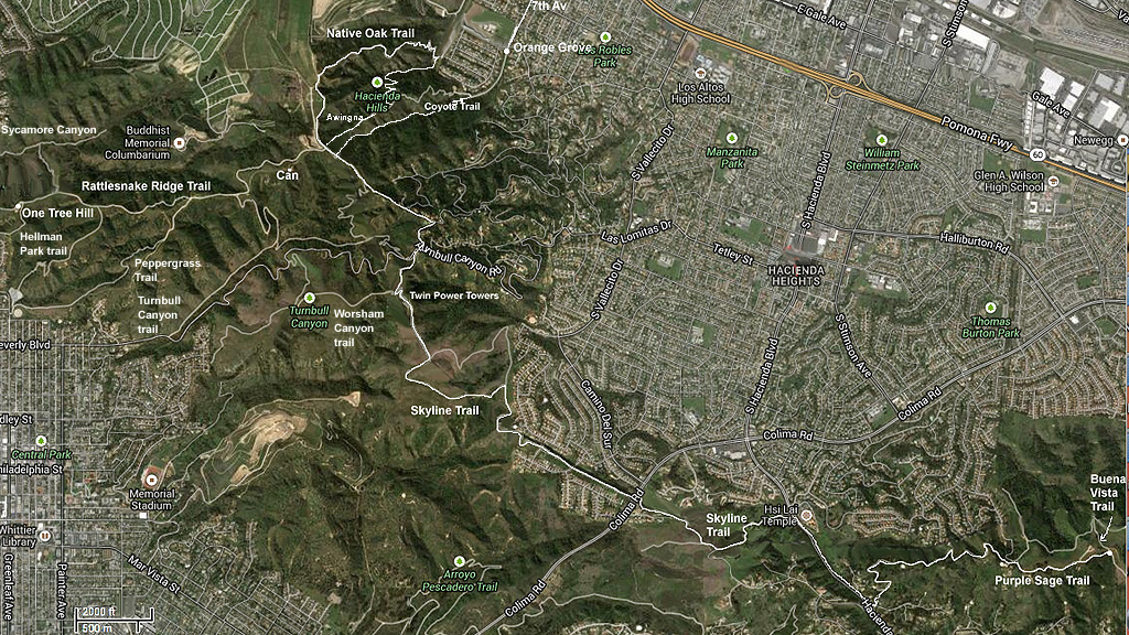
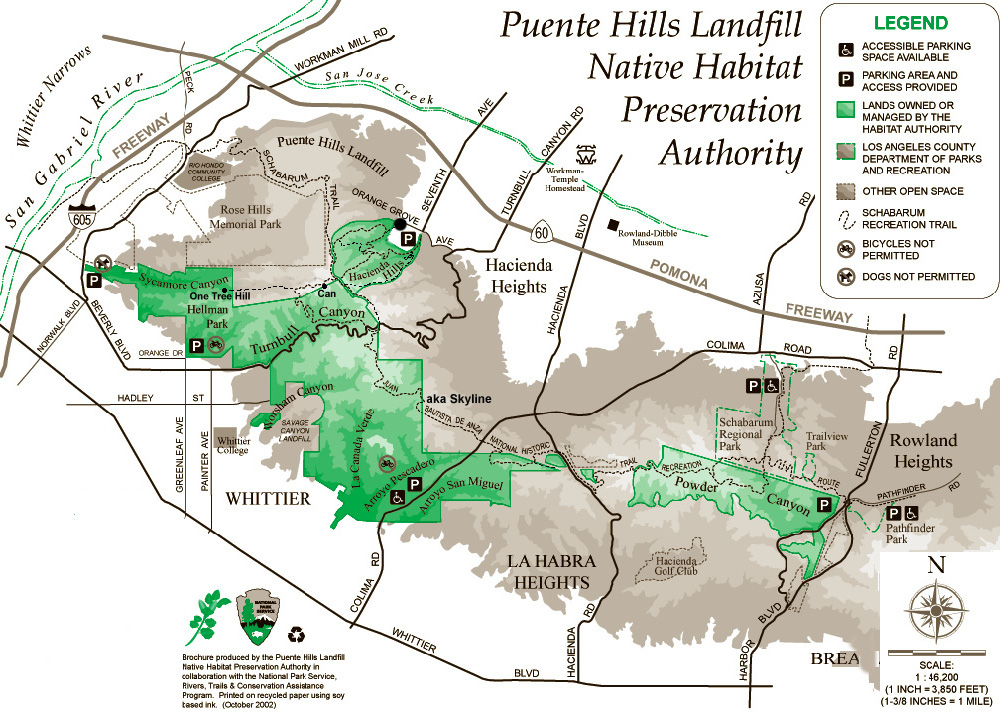
There are miles and miles of great trails, including the Skyline Trail in the Puente Hills between the 605 and 57 Freeways - see the map below and info on the Puente Hills trails. This is a good close by alternative to our San Gabriel Mountains. You really cant get lost for long going east because an Edison road runs the length near the top of the hills - the high tension lines and poles are very visible. Going west, the dirt road goes next to a large water tank and splits off in a few directions. One will take you down into Whittier and the other comes out in a valley to Workman Mill Rd just south of Rose Hills.
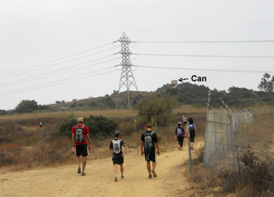
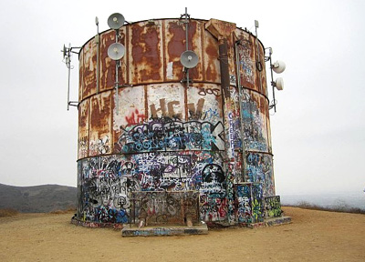
For first timers we suggest going up the canyon on the Ahwingna Trail and left at the junctiion of the Native Oak trail and on up to the Skyline Trail. Turn left at the chain link fence and find the Coyote Trail within 100 yards east. This brings you down to the trail head at the end of 7th Ave. Best view of LA and the sunset is up at the can. Takes about 30-40 minutes to get to the can. Round trip is 2.7 miles with 660 ft altitude gain.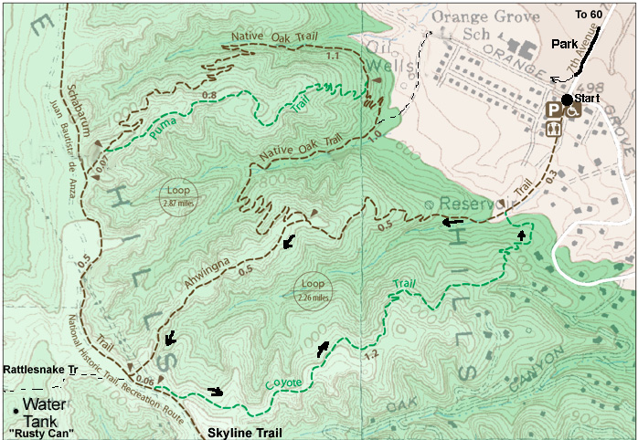
Click on the map and print out a copy to take with you on the run.
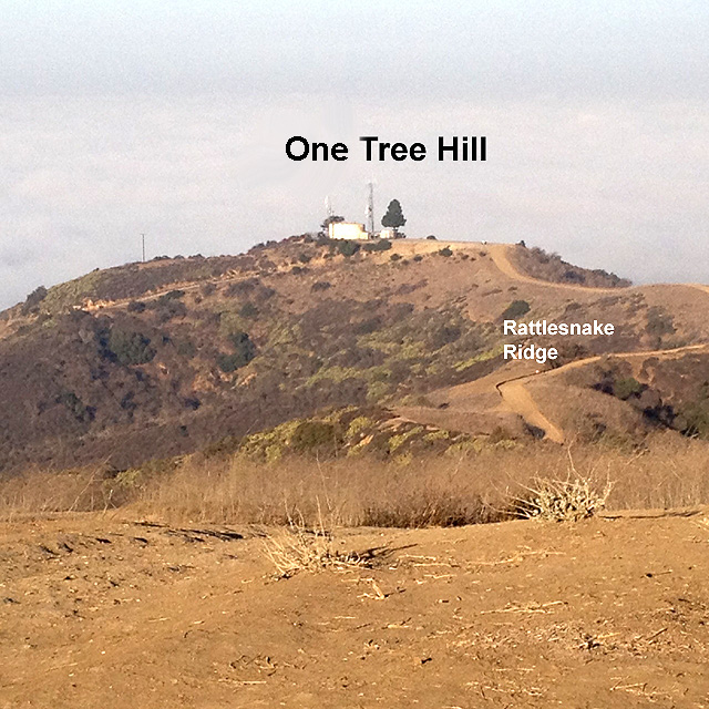
One of the short week training runs for the Catalina Eco Marathon is a 2.5 hr, 7 mile round trip run up the Ahwingna trail and then out past the old metal water tank (rusty can recently painted) to the west on the Rattlesnake Ridge trail to "One Tree Hill" - touch the tree before you turn around. On the way back, come down the Coyote trail.