Foothill Flyers Mountain Trail Runs
Last update Oct. 10, 2024
Return to: Trail Routes & Maps - Foothill Flyers - Weekend Warriors
Echo Mountain - Inspiration Point, Altadena
Sam Merrill and Castle Canyon Trails
 Fast hikers can make it to the Echo Mountain ruins in about 1hour. Check out the great Trail map at the Scenic Mt. Lowe Railway Historical Committee's web site. There is no water on this loop so carry enough to last you depending on conditons - Check the Altadena Weather Cam.
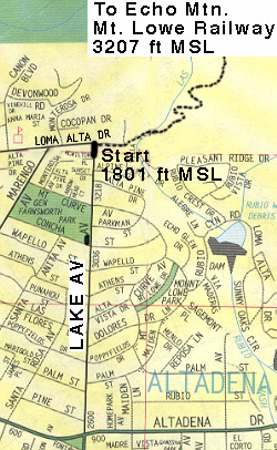
The start is from the very top of Lake Av in Altadena. From the 210 take the Lake Av off ramp and go North about 3.7 miles toward the mountains til you cant go any farther (at Loma Alta Dr.) Park on Lake Av. or Loma Alta Dr. Parking can be sparse depending on the season, and if the case, consider parking at Farnsworth Park in the lot on the NW corner of Lake Ave and Concha St.
The trailhead is at the NE corner of Lake and Loma Alta. Run east about 100 yards along the fence until you come to the trail sign and a drinking fountain. Do not take the Altadena Crest Trail to the left of the drinking fountain. Go to the right of the drinking fountain for about 20 ft and take the single track on the left above a little valley, past the north side of the coffer dam, and across and back up the other side to the start of the switchbacks. 2.7 miles from Lake Ave up the Sam Merrill Trail, you will come to the top and a trail junction. From there you will go south (right) on the old Mt. Lowe Railway bed about 100 yards, past the upper Sam Merrill Trail and Castle Canyon trail junction and you should see the large cable car gear at the ruins. Plan some time to explore the ruins of the hotel, restaurant, zoo and observatory and see the historical marker photos and narratives, it is well worth it. The Cable car started at a pavilion built in Rudio Canyon and is another interesting historic hike you can take from the top of Lake Ave.
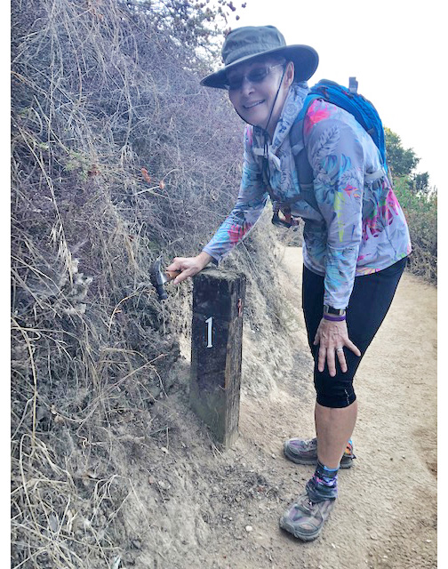 This trail is run on the last Wednesday of September as one of our club mountain trail runs. Sunset is around 6:45pm so plan your start time and distance goal accordingly. Walkers starting at 6:00pm can make it to the 3rd Bench overlook a little more than a mile up the trail to watch the Sunset at 6:45pm. Runners should be able to make it to the White City and Mt. Lowe railway ruins before the turn around at 6:45pm by starting at 6:00pm at a 15 min/mile pace and be back down in 30 minutes. Bring a flash light, it can get dark in the shadows of foliage making it too easy to trip on rocks as you come back down. Thanks to Robert and Maria, your flashlight will light up the the number on the 1 mile post.
For those interested in the history of the Mt. Lowe area check out the history of the Mt. Lowe Railway, Mt. Lowe Preservation Society, Mt. Lowe Railway Historical Committee and Rubio Canyon web sites.
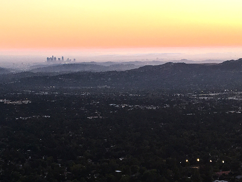
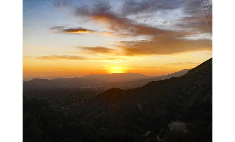
Great views like this one just after sunset looking toward the high rise buildings in downtown Los Angeles.
Bench #3 is located about 200 yards up from the 1 mile marker post and is a good place to take a break or watch the sunset. There are also small benches about 3/4 mile up the trail and just before the 1 mile marker post but they do not have the view.
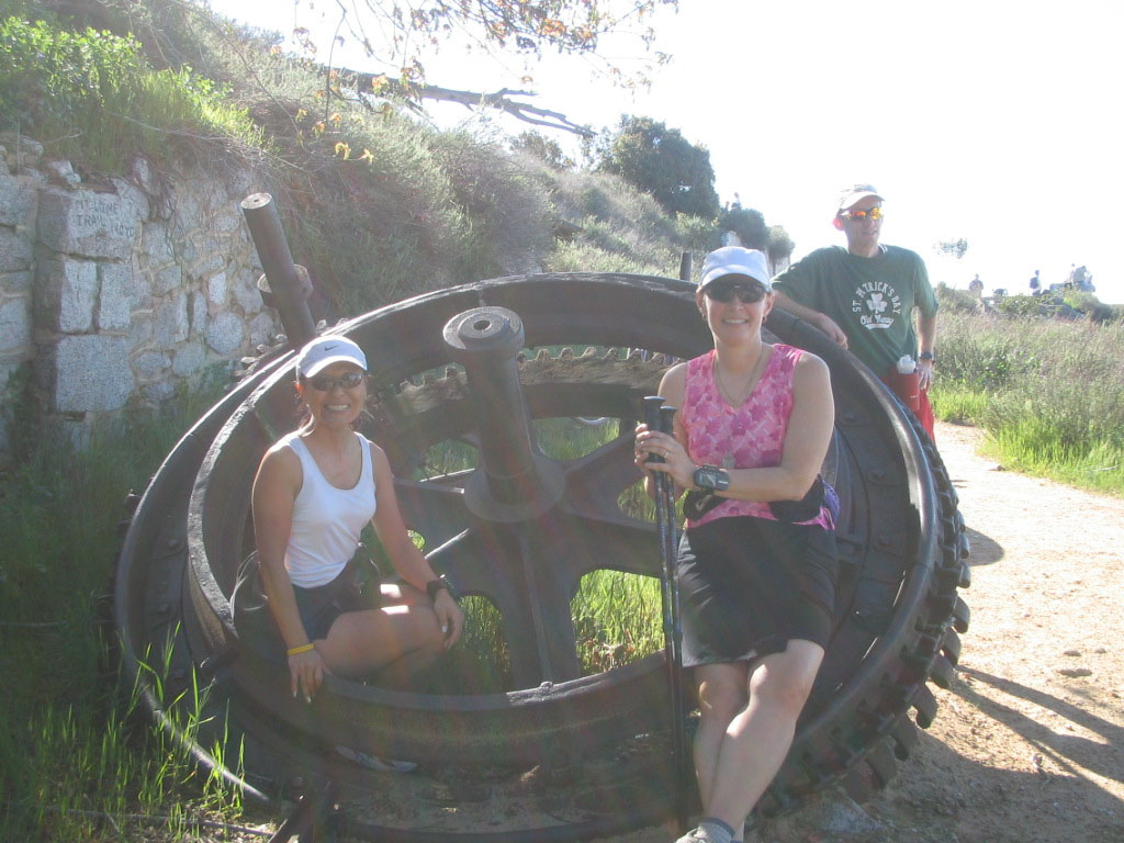
L to R: The Bullwheel was the center of power pulling the long 1" cable with the 2 Incline Cars attached up and down the Great Incline to Rubio Canyon below; Mary Ann yells at Tom through the Echo megaphone.
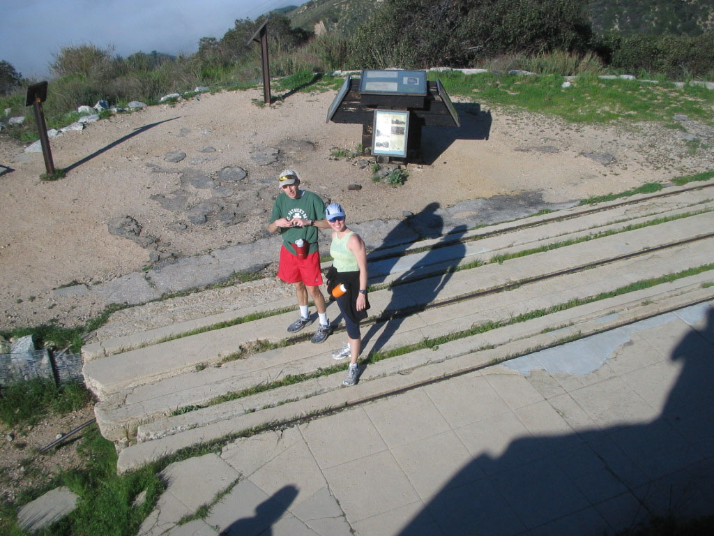
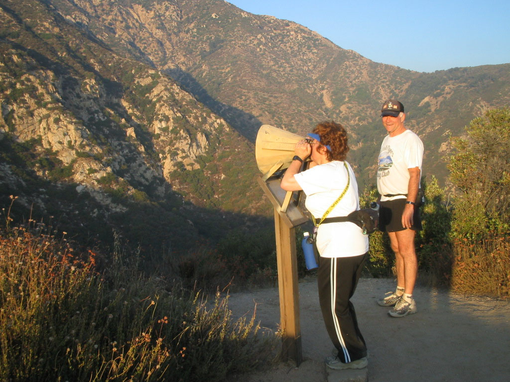
L to R: Robert stands atop the ruins of the restaurant entrance steps; just below the steps is the cable car landing with the historical signs
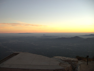
Picture at right is looking SW toward the LA city high rise just after sunset from the Incline Railway landing.
From Echo, you can extend the run to the Inspiration Point Sight Tubes for a total round trip of just under 10 miles from the Top of Lake. The shortest trail from Echo to the Sight Tubes is via the Castle Canyon trail. However, it gets very steep after a mile with many switchbacks. Best to make a loop of it going up the Castle Canyon trail and returning back down the Sam Merrill Trail. A longer but easier route is to take the Mt. Lowe Railway trail from Echo Mtn to the Mt. Lowe Truck Road for a round trip of 13.5 miles.
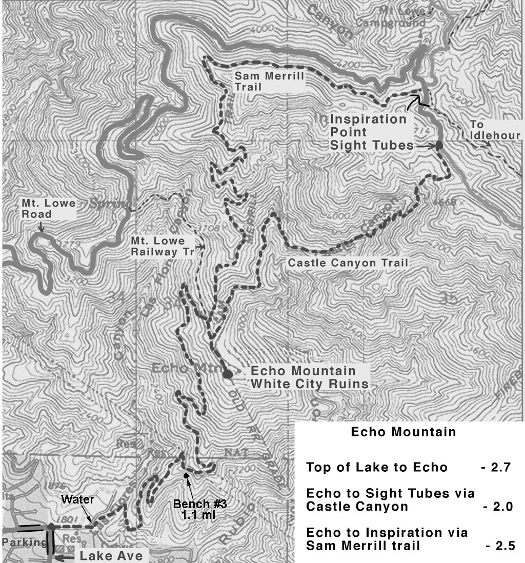 Click on the map to download a copy to print out and take with you.
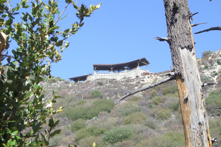
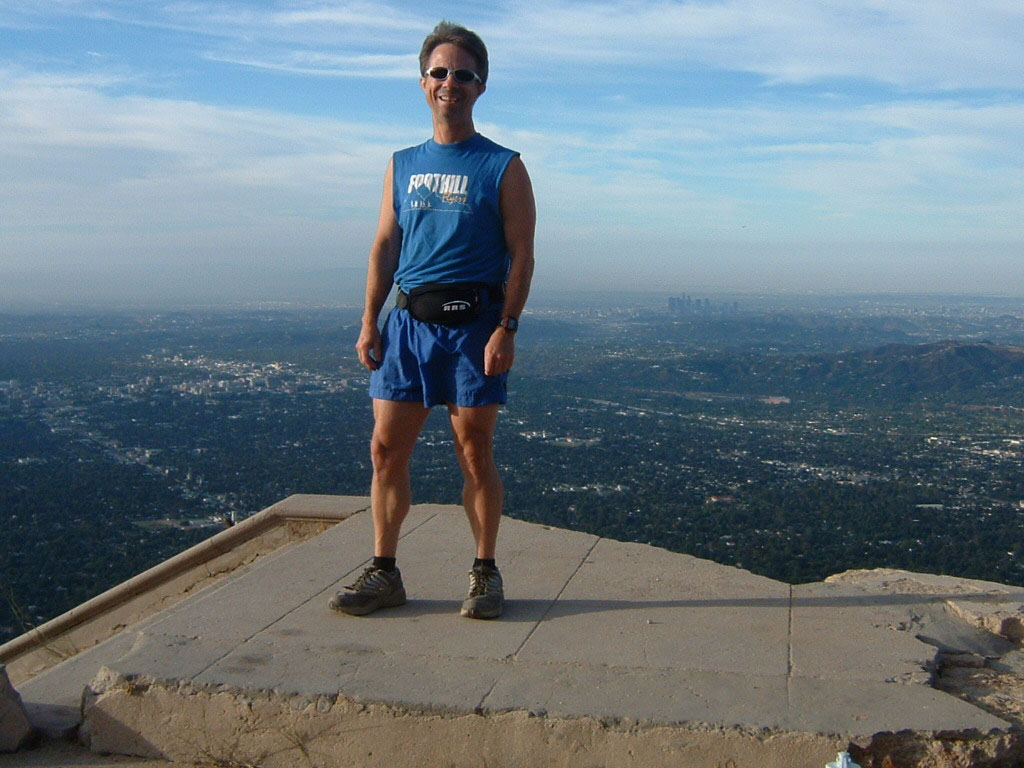
View of Inspiration point and the Sight Tube structure just after you round one of the many switch backs on the Castle Canyon Trail. Altitude is 4400 ft msl.
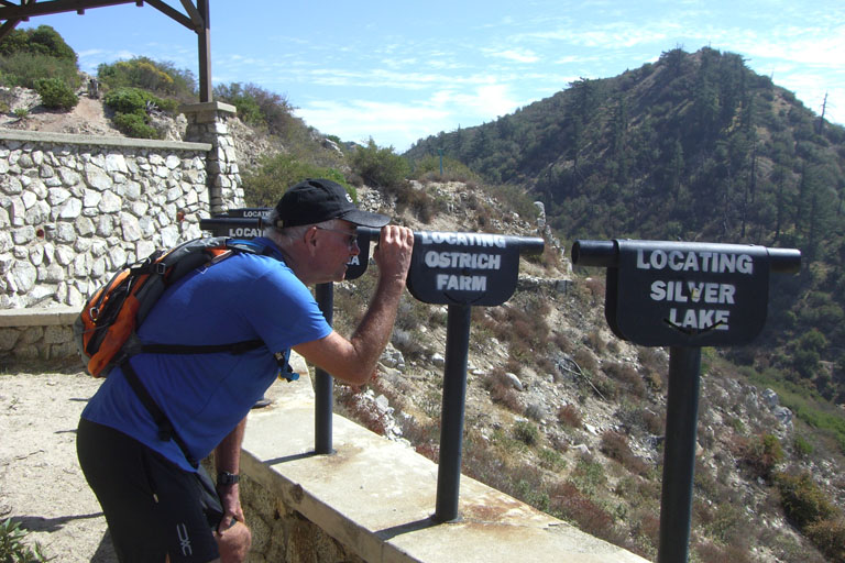
Yes, there used to be an Ostrich Farm in South Pasadena you could see through one of the sight tubes on a clear day.
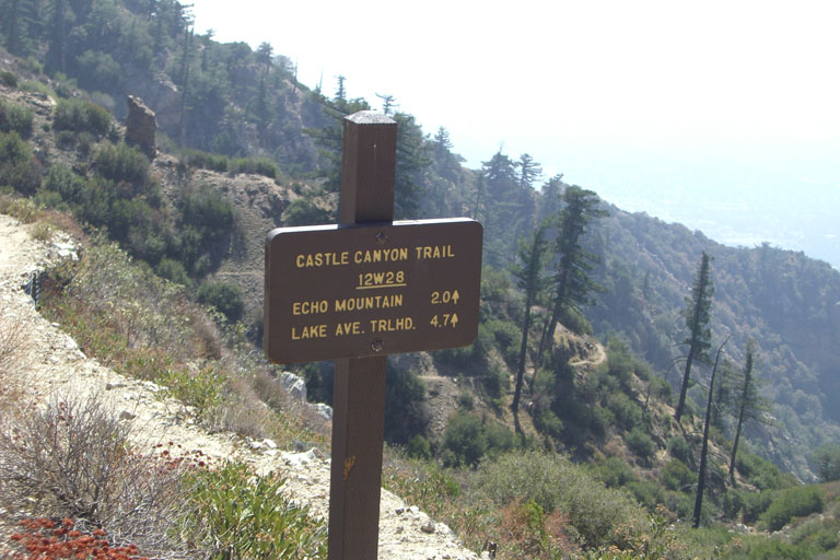
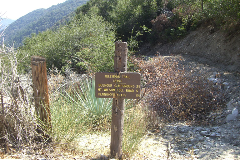
Trail signs at the top of the Castle Canyon and the Idlehour trails.
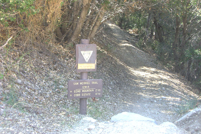
Top of Sam Merrill trail sign at the junction of the Mt. Lowe road, Idlehour trail and road to the Inspiration Point Sight Tubes. The Cobb Estate is where the trail starts at the Top of Lake Ave.