Foothill Flyers Mountain Trail Runs
Last update August 24, 2009
Mt. Baden-Powell Trail Run/Hike
Weekend Warriors photos from August 2009
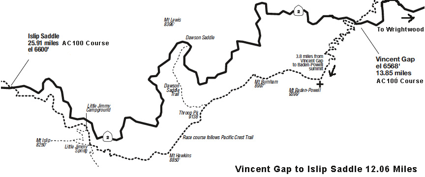
When your usual training routes on the streets or the lower altitude trails get too hot in the summer, the higher altitude ones along Highway 2 can be cooler and a nice change. The views can be spectacular too. Mt. Baden-Powell with it's 9399 ft peak is a good training run/hike before the Mt. Baldy Run to the Top. You can go 7.6 miles up and back from Vincent Gap, or workout car pooling and leave some vehicles at Islip Saddle and go 12 miles on the AC100 course. If you do go on the long one, don't miss the best water in the San Gabriel Mountains at the Little Jimmy Camp ground.
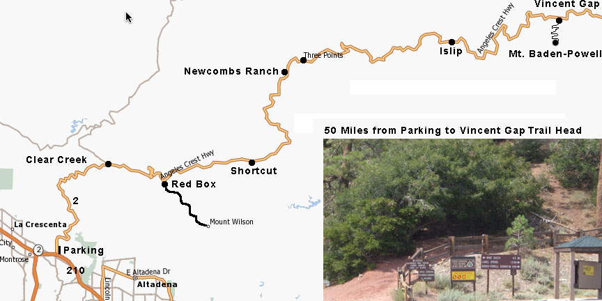
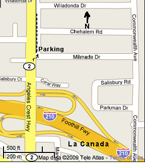 Groups often meet just north of the junction of the 210 freeway and highway 2 on Angeles Crest Highway and Milmada St in La Canada - Thomas Map 535-B3. There is a median that separates the east side of Hwy 2 from a parallel street which is best for parking.. From there they can car pool the approximately 50 miles on Hwy 2 to the Vincent Gap parking lot. It is best to meet early, like 6 AM given the drive time from the 210/2 to Vincent Gap. Plan on 1.5 hrs drive time depending on traffic and rocks on the road. Drive carefully along the slide area between Dawson Saddle and Vincent Gap watching for rocks that have come down on the highway.
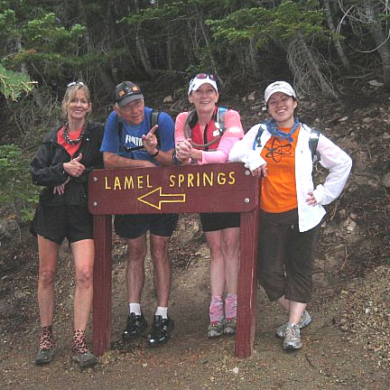
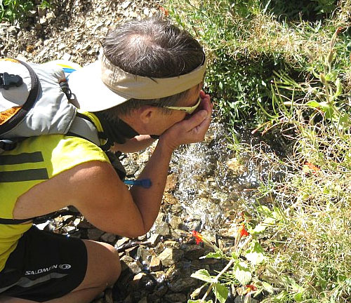
At the parking lot west side is the trail head and the outhouse head. New mile marker signs have been put in and around 1.9 miles up the trail is a sign with a cut off to Lamel Spring which is a good place to regroup. The sping is about 100 yards from the junction and has good tasting cold water. I suggest tasting it on the way back down rather than on the way up in case you are low on water on the return. Also if the water is not flowiing, I would suggest not drinking it.
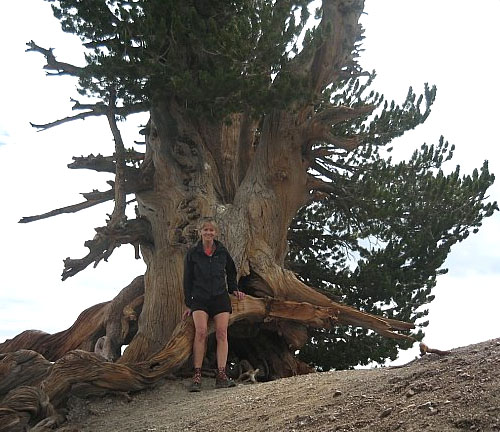
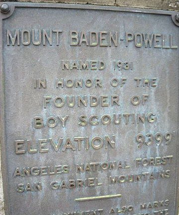 Just before the top, the Pacific Crest Trail splits off to the right and goes down hill to the west. Next to this junction is one of the oldest trees in the San Gabriels - the Wally Waldron Tree estimated to be 1500 years old . Take the PCT if you want to come out at Islip Saddle as a longer alternative than up and back Baden-Powell. On top is a monument to Lord Robert Baden-Powell (1857-1941) as founder of the Boy Scouts, so you can expect to see groups of scouts hiking this trail in commemoration.
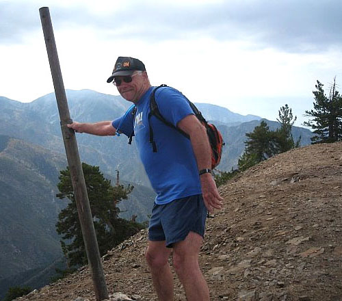
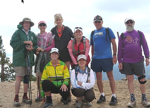
On the east side of the peak is the highest point with a metal pipe sticking up. Our tradition is to touch this pole to be official. Looking out SE from this pole you can see the back side of Mt. Baldy. Looking west you can see the TV towers of Mt. Wilson. North is the Mojave high desert and south the Inland Empire.
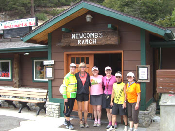
Plan on being on trail for a little under 4 hours doing the up and back given some time to explore and take pictures on top and to check out Lamel Spring. Newcombs Ranch is a good place for lunch on the drive back - great burgers and fish tacos plus 3 Pasadena Craftsman beers on tap.
 Hal Chaisson comments:
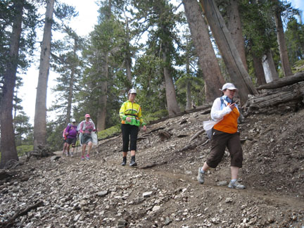
Baden Powell is actually not that bad...the 1st 1/4 - 1/2 mile is steep...then it somewhat levels out with long switchbacks. About a mile below the top it starts to get steeper, with short switchbacks. There are elevation signs - some of which are illegible - but they give you a clue as to how far from the top you are and based on the elevation.
Two to three bottles should be enuf to get you up & down, although 3 1/2 (approx 70 oz) might be better if you're taking your time and it is hot. About half way up there is a narrow trail off a switchback that leads to a spring - about 100 yards - and is a good place to regroup. At the top, if you look to your left, you'll see the back side of Mt Baldy...it will appear to be about the same altitude, but actually Baldy is about 700 feet higher. You may get lucky & see some sailplanes as well...great views of the desert up there...and again, have fun.
 From the Angels Crest 100 Mile Trail Race description:
A special feature of the AC100
segment of the PCT is the trail that climbs
from Vincent Gap (mile 13) to Mt. Baden-
Powell (9,399 feet), the second-highest
peak in the San Gabriel Mountains. The
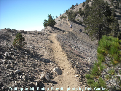
trail up Mt. Baden-Powell climbs 2,800
feet in 3.6 miles over 41 switchbacks to a
saddle 100 feet below the peak.
One half mile from the 9,000' summit are the first scattering of ancient Limber Pines. Up to 2,000 years old, these trees were identified in 1962 by Angeles National Forest Supervisor Sim Jarvi. Only the great Sequoias and Bristlecone pines are known to be older. The bottom of the East Fork of the San Gabriel River may be seen more than a mile below the summit of Mt. Baden-Powell. Across this rugged chasm looms the massive peak of Mt. San Antonio (Old Baldy 10,064 feet), the highest peak in the San Gabriels. On a clear day, the San Gabriel Valley and other distant mountains are visible, as well as part of the Mojave Desert to the north. From the signpost at the saddle near Mt. Baden Powell, the PCT section of the AC100 course then descends to Mt. Burnham (8,997'), Throop Peak (8,789'), and Mt. Hawkins (8,850') through Windy Gap and passes Little Jimmy Spring. This perennial spring is not to be missed. Then past Little Jimmy Campground to Islip Saddle (6,640', mile 26), at the base of Mt. Williamson. There is a toilet at Islip Saddle.
|
|
Back to: |
|
The location of this page is Foothillflyers.org
copyright ©2012 Tom O'Hara. All rights reserved. Webmeister contact: tomsmb at aol dot com |